San Antonio Valley and Del
Puerto Canyon (Spring)
May
1, 2021
From Narrow Canyon to Wide Valley—The Long Road to
Recovery
BY MATTHEW DODDER
For many years, local birders chose to visit Mines Road
during spring to search for some highly-prized species such as Lewis’s
Woodpecker and Lawrence’s Goldfinch. The recommended route took
folks through Livermore. After climbing miles of scenic road and crossing from
Alameda County into Santa Clara, birders eventually descended into San Antonio
Valley where county listing resumed. They’d stop at the cattle guard near the
fire station in hopes of finding birds in the vast chaparral slope. But Del
Puerto Canyon was often passed by, in favor of San Antonio Valley just to the
south. After a long day, birders could either backtrack to get home or keep
going and brave the narrow winding road up and over Mount Hamilton.
The adventure represented a full day
of birding, but usually a lot of target species were acquired, including Bell’s
Sparrow, so it was definitely worth it. I’ve made this journey at least 40
times over the years and often taken class groups with me.
Maybe it was just my restlessness, but
at some point I decided the experience could be improved if we changed the
direction of the tour. Although it shifted the emphasis to Stanislaus County,
it seemed the birding was more relaxed and roadsides a little more conducive to
stops. It also seemed more exotic somehow. So, I changed the route to begin
from Hwy 5 just outside of Patterson on Del Puerto Canyon Road.
The
grassland and rich cottonwood riparian habitats located in Stanislaus provided
more opportunities to find Grasshopper Sparrow, Blue Grosbeak, Cassin’s
Kingbird and Phainopepla early in the day before heat made scope
views shimmery. There was also the chance to find Costa’s Hummingbird in
areas where tree tobacco was blooming.
I
try to avoid telling stories of birds that “used to be found here”, or worse,
“was once found here—right there in that tree”. We’ve all heard those
stories, usually told by experienced birders to less experienced ones, the ones
who would much rather know what’s here now, and what can be seen today.
Not what used to be here…
To
do that, though, I do need to give some context. It’s important to know where
the birds were and to understand what they required, since only then be able to
predict where they might show up in this altered environment.
Trip
Covers: April - June
KEY
BIRDS: Wood Duck, Greater Roadrunner,
Costa’s Hummingbird, Swainson’s Hawk, Northern Pygmy-Owl, Burrowing Owl,
Lewis’s Woodpecker, Olive-sided Flycatcher, Ash-throated Flycatcher, Cassin’s
Kingbird, Western Kingbird, Loggerhead Shrike, Horned Lark, Rock Wren, Canyon
Wren, Phainopepla, Lawrence’s Goldfinch, Grasshopper Sparrow, Chipping Sparrow,
Lark Sparrow, Bell’s Sparrow, Rufous-crowned Sparrow, Yellow-breasted Chat,
Tricolored Blackbird, Blue Grosbeak
HOW
TO BIRD
Del
Puerto Canyon Road is a 25 mile paved road from Hwy 5 to San Antonio Valley. It
is remote but has a surprising number of trucks carrying livestock, water and
fuel to-and-from the various ranches. The trail is also popular with
motorcycles. Birding must therefore be done from the many pull outs along the
road, with a constant watch for oncoming traffic. The path crosses from
Stanislaus County into Santa Clara County if one begins from the east end (as this
account recommends). From the “Junction” at mile 25, one can then drive north
along Mines Road toward Livermore while still in Santa Clara, or drive south on
San Antonio Valley Road. Both directions will take you back to the Bay in
roughly the same amount of time. If you choose to head home via San Antonio
Valley Road, you will drive up an over Mount Hamilton where fire damaged
landscape prevails but birds can still be found. I feel car sick just thinking
about it…
PERSONAL CONNECTION: Years ago, my class toured this area each spring in a
caravan. I recall, only a few of us had cell phones but they didn’t work in
this area anyway. They still don’t now. We hadn’t yet adopted the use of
walkie-talkies like we do today. So it was a very different experience than it
is now, especially with the recent fires.
I’ll
begin this self-guided field trip by suggesting some historically productive
stops, but afterward I want to suggest a new way to explore this area, or maybe
I should say, a new attitude.
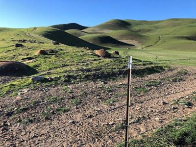
WHERE TO LOOK FOR BIRDS
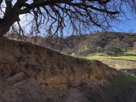
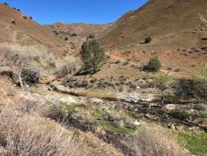
The
rock (Mile 0) Before
beginning your drive, zero-out your odometer at the “Rock”, which is
found at the east end of Del Puerto Canyon Road and reads “Frank Raines
Park 16 Miles Ahead”. (All mileages in this account begin at this rock 37.463440,
-121.185396 - see interactive map.)
Mile zero. Photo by Matthew Dodder
Drainage Photos by Matthew Dodder
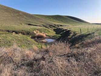
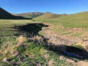
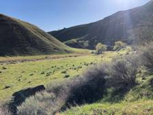
The grassland (Mile .1 - .4)
The first habitat you will see is
the grassland section, featuring rolling hills of short grass. Cattle is
frequently found here so the grass is often quite short. A drainage at 0.1 mile
(37.464400, -121.190305, #1 on map) is usually the first stop I make. Being quite
close to Hwy 5 and the Patterson agricultural lands, it is not uncommon to find
Swainson’s Hawk in these low hills. On the hillside you may hear Grasshopper
Sparrow or in the morning see them perched on the barbed wire beside the
road. Western Kingbird and Loggerhead Shrike are usually easy to
find here. Blue Grosbeak may be found anywhere from the drainage here to
the Owl Rock several miles away. Blue Grosbeak is drawn to moistened drainages
and orchards where shrubs and small trees provide nesting habitat. Lark
Sparrow is occasionally found here as well but they tend to prefer the
areas closer to the cottonwoods.
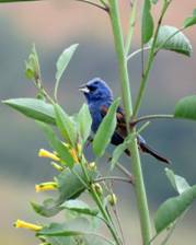
Blue Grosbeak Photo by Gena Zolotar
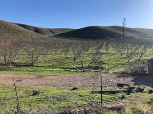
The old orchards (Mile 0.6)
More than a decade ago, much of the
grassland section was supplanted by an orchard which, due to lack of water,
eventually died (37.469169, -121.194670, #2 on map). The trees remain standing in many places, but
most have fallen. What was previously good habitat for Grasshopper Sparrow
began to attract Blue Grosbeak, Bullock’s Oriole, Ash-throated
Flycatcher and other birds that require trees. Now it attracts neither for
the most part, but I keep looking.

The
towers. Photo by Matthew Dodder
The towers (Mile 1.7)
High tension power lines cross the
road just after the parched orchards (37.478901, -121.209430, #3 on map). Here it is best to pause and scan the
structures for Raptors such as Red-tailed Hawk, Golden Eagle, as
well as Prairie Falcon. It is not uncommon for both Western or Cassin’s
Kingbirds to make use of these towers for their nests.
The water trough (Mile 2.3)
Just after passing the towers, a
water trough stands in a flattened area to the left side of the road (37.477768, -121.218668, #4 on map). The bare earth in this area attracts any American
Pipit that might remain in the area, as well as resident Horned Lark.
The barbed wire frequently has small numbers of Lark Sparrows. Rock
Wren may be heard beyond the meadow on the escarpment across the road. On
several occasions, we have also found Burrowing Owl near the base of the
towers or in the short-grass areas, but one must be patient to find them.
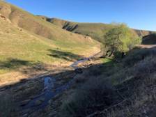
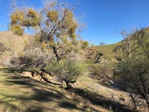
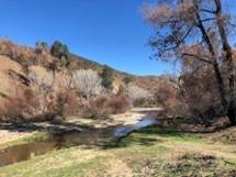
Entrance to the cottonwoods Creek with cottonwood tree Creek entering the canyon
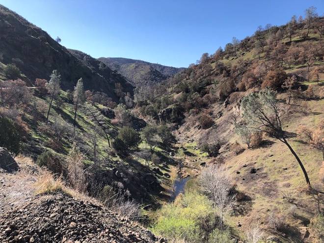
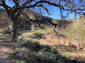
The cottonwoods (Mile 3.3)
There is a beautiful section of the
road that follows the creek closely (37.473798, -121.235473).
It is filled with large Cottonwood
trees that thrive near the water below the road and a steep slope above the
road hosts large and beautiful Blue Oaks. As you might expect, the abundance of
trees attracts a variety of birds from the noisy Western Kingbird and Ash-throated
Flycatcher to Lark Sparrow and Bullock’s Oriole. As with any
oak habitat, watch for oak mistletoe (Phoradendron villosum). If there’s
mistletoe, there’s also likely to be Phainopepla.
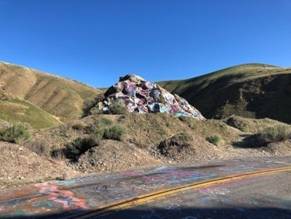
The
rocks and chaparral (Mile 3.5) On
the far end of the cottonwood section, the creek takes a sharp bend around
a large rock decorated with spray paint (37.474387, -121.238302). This
is “Graffiti Rock”. It is not safe to park your car here, but you
may drive up to the next stop and walk back along the road carefully. Be
very aware of passing vehicles along this section.
Unfortunately, the only way to bird
this area is to pull off the road either just before or just after the
cottonwood section. It is risky to walk along the road and the utmost care is
required. Keep a watchful eye for fast moving vehicles and be sure to stay off
the pavement as much as possible while observing the creek. I always scan
along the creek for Dragonflies. Common Green Darner, Eight-spotted
Skimmer, and Common Whitetail are all possible here.
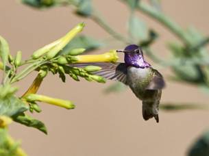
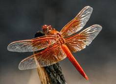
Costa’s Hummingbird by Brooke Miller
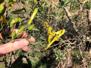
You will likely notice a few straggly shrubs with bright
yellow tubular flowers. This is Tree Tobacco (Nicotiana glauca) and it is a
favorite food source of Costa’s
Hummingbird. The plant and the bird are intimately connected,
and these flowers are greatly responsible for the expansion northward of the
desert-loving Hummingbird into our area. Look for the plant and watch for any
birds drawn to it. Chances are you may find the tiny purple-throated Costa’s Hummingbird.
If your ears are sharp you may also hear the birds rising-and-falling courtship
“song” which clocks in at 12,000 Herz, almost twice as high as Brown Creeper
and beyond most people’s hearing.
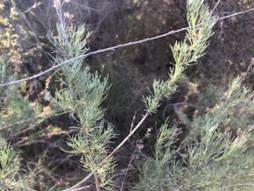
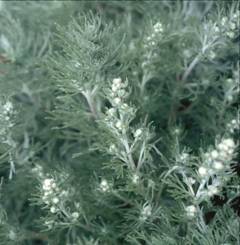
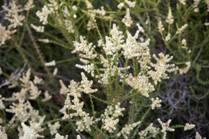
This area, with its outcroppings of large boulders and
California Sagebrush (Artemisia
californica) is also home to Rufous-crowned
Sparrow, Canyon
Wren, and of course, Rock
Wren.
The
canyon (Mile 3.7) Just
around the corner is “Owl Canyon” and careful investigation of the
small caves on the rocky wall across the road may just prove why. Barn
Owl and Great Horned are often seen huddling deep in the
shadows. A scope is recommended and patience to let your eyes adjust to the
darkness within the caves. In good years, I have seen Great Horned Owlets
clambering around in a nest in full view, but that is not common.
As with the cottonwood section just before, any water in
the creek means Dragonflies might be present. Look for them, but also the birds
that might like to eat
them—birds like Western
Kingbird, Ash-throated
Flycatcher, and Olive-sided
Flycatcher.
Oak Savanna Habitats
The savanna (Mile 4.2)
For the next few miles, pullouts will be rare. Birding
however can be good from one’s vehicle or on long straight aways where
visibility of traffic is unobstructed. Birds seen anywhere along this section
include Golden Eagle,
Yellow-billed Magpie,
Loggerhead Shrike,
Rock Wren,
Canyon Wren,
and Lark Sparrow.
One particularly good place to pull off is near Oasis Ranch at Mile 9.6 (37.441329, -121.300405).
Habitats for the
Canyon Wren
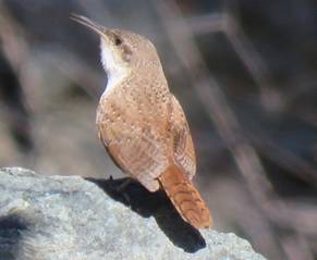
Canyon Wren
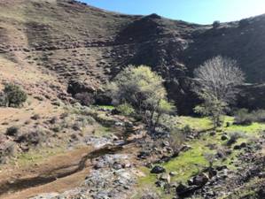
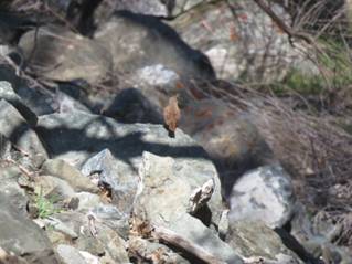
The crossing (Mile 10.7)
The road will climb gradually after
the savanna reaching another great stop where the creek crosses from your left
to your right. On the left of the road is a wide turnout where you will want to
stop and explore (37.441720, -121.312843).
Examine the cliff wall directly
above your car and scan for Rock Wren and Common Raven activity.
Both nest here. And if you haven’t found Rufous-crowned Sparrow yet
today, this is an excellent spot. Search among the rocks where Artemisia grows
and listen for their distinctive “peer peer peer peer peer” call.
Greater Roadrunner frequents this area too and will most likely be found by
scanning the gravel road across the creek and the rocky ridge. Canyon Wren
is often heard singing below the road along the creek. It is not uncommon to
find a variety of Swallows here, including Northern Rough-winged, Violet-green,
and Tree Swallows.
The creek below the road is often a
good place to see a few Dragonflies, such as Flame Skimmer and Cardinal
Meadowhawk.
Flame Skimmer Del
Puerto Canyon Cardinal Meadowhawk
The edge (Mile 12.3)
There are few places to stop along
this stretch, but one or two turnouts with just enough room for a couple of
cars provide spectacular views of the creek far below (37.438218,
-121.336253). Here it is best to pause for a
minute, wait for your engine to stop making those funny pinging sounds, and
listen for Canyon Wren. You may hear other birds as well, probably
nothing new for your list, but there’s a special magic to the Canyon Wren’s
song when it’s heard from an overlook. The utter quiet of this area, as long as
motorcycles are not near, is wonderful and worth a few minutes to experience.
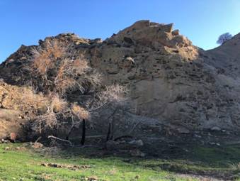
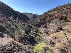
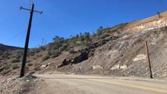
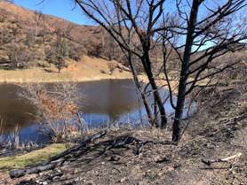
You will likely have noticed the extensive fire damage in this area as well. If
not, be patient, it will be impossible to miss fairly soon.
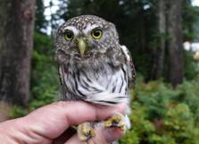
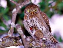
Riparian Habitat – “Supposed” lair of the (Northern or
California) Pygmy Owl
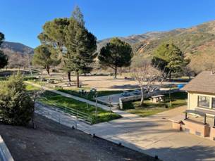
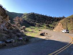
The park (Mile 15.8, restrooms)
After you pass into the Minnear
Day Use Area (Frank Raines Regional Park) you will see a large pullout on
your right beside the creek (37.424465,
-121.342621). This is often a good location to
find Warblers such as Common Yellowthroat, Nashville Warbler, MacGillivray’s
Warbler, and even Yellow-breasted Chat. There’s no telling what will
be there, but it’s worth exploring. One can even access the water by following
a short trail from the gravel lot. Purple Finch and Ash-throated
Flycatcher will probably be heard from this area too. This is also
frequently described as the most dependable area for Northern Pygmy-Owl;
however, I have usually encountered them a bit further up the road at Frank
Raines OHV Park (37.420642, -121.372912).
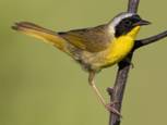
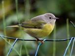
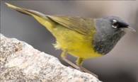
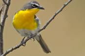
Common Yellowthroat Nashville Warbler MacGilivray’s
Warbler Yellow-breasted Chat
Stop 12: The quarry A wide turnout on the right provides
a good location to search for Canyon Wren, Rock Wren and Rufous-crowned
Sparrow. The lush riparian vegetation sometimes provides cover for various
surprises—most notably, Yellow-breasted Chat (37.411682,
-121.406425).
Adobe Springs – High Magnesium
(Healthy) Water!
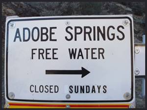
A one-minute drive will find you at
Adobe Springs, a curious place where parking for one or two cars can be found
just across the creek. In addition to the birds just mentioned this is
particularly interesting to anyone who loves Dragonflies. Grappletail, Pacific
Spiketail, and the lovely American Rubyspot can be found here quite
often (37.408802,
-121.409056).
The County Line
Welcome to Santa Clara County! Start
a new eBird checklist now…. (37.391607,
-121.450419).
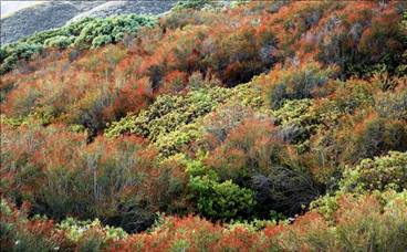
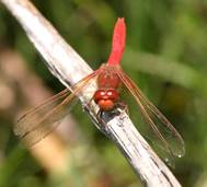
The chaparral
There is a large, uninterrupted
slope of chaparral on your left, about half a mile further (37.385960,
-121.454361). Here is one of the best spots to
look for Bell’s Sparrow along this tour. The birds may show up on either
side of the road, as their favorite plant Chamise (Adenostoma fasciculatum)
is found here, and they respond quite well to pishing. Be aware that when the
Bell’s Sparrows are near, they make a soft call quite similar to Dark-eyed
Junco. Other birds in this habitat include California Thrasher and Blue-gray
Gnatcatcher.
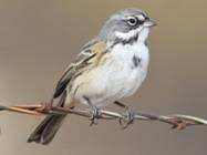
Chamise - drought resistant shrub Bell’s Sparrow Chamise – fire season predictor
The pond
A half mile further you will reach a
small pond on the right side of the road. Despite its size, this spot supports
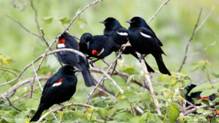
one of the largest colonies of Tricolored Blackbird in Santa Clara
County (37.384473,
-121.462947). Red-winged Blackbirds also
make use of the reeds here for their nests, but the Tricoloreds dominate. It is
a good opportunity to compare their coloration and call. The Tricolored
Blackbird is a vibrant glossy blue-black and has a deeper red epaulette with a
white margin. Our local Red-winged Blackbirds are of the “bicolored” variety
which lack the yellow margin seen elsewhere in their range. Their calls are
different as well, with the Tricolored sounding much like an angry cat, somewhat
similar to Yellow-headed Blackbird. The other difference between the two
species here is the way they fly and flock. Watch for the tight groups of
Tricolored as well as their smoother flight. Dragonflies abound here. Western
Pondhawk, Flame Skimmer, Cardinal Meadowhawk, Blue Dasher,
Common Green Darner, Common Whitetail, Eight-spotted Skimmer…
all there, buzzing around the Pied-billed Grebes and their young.
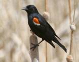
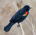
Tricolored Blackbird with white
bar… Which are these? Red-winged
Blackbird with yellow…
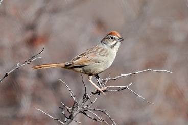
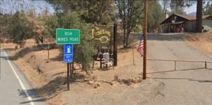
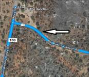
The Junction (restrooms)
Take a right toward Mines Road to
stop here. Back track just a bit to stay on CA-130 or… This will be a welcome
stop for weary birders. There is a restroom and a diner that attracts car
clubs, motorcyclists and endurance cyclists. There are cold drinks and food
available inside and a nice place to sit and reflect on your day. You can also
use this as an opportunity to decide which direction to go after you rest. Most
importantly, this is also a great opportunity to look for Lawrence’s
Goldfinch, Chipping Sparrow and nesting Violet-green Swallows, all
of which have been recorded from the picnic table outside the bar (37.392175,
-121.489719).

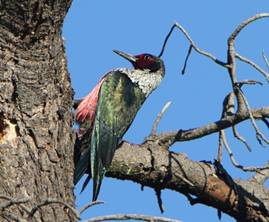
SOUTH on San Antonio Valley Road
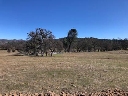
Lewis’s
Woodpecker habitat
The green and pink
Immediately after turning south onto
San Antonio Valley Road, you will be greeted by a broad valley with widely
spaced valley oak trees with acres of grass between. This habitat remains a
haven for Lewis’s Woodpecker, the only glossy green and pink Woodpecker
in North America! In addition, it is the only Woodpecker that flies without
undulating as the other members of its family. In fact, since it looks black at
a distance, the Lewis’s Woodpecker appears at first to be a smallish Crow. If
you see any “crows” sallying out and grabbing flying insects from the air….
Well, that’s probably not a Crow. The species shows up anywhere in the
valley, but is especially fond of large valley oaks and gray pines which it
uses both for watch posts and nest sites. It is the bird to find in this
area. Spend time about half mile south from the Junction and watch for passing
vehicles. Western Kingbird, Ash-throated Flycatcher, Western
Wood-Pewee, Phainopepla, Chipping Sparrow and Lawrence’s
Goldfinches are also all found here (37.385131,
-121.491169).
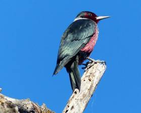
Lewis’s Woodpecker – Photo by Gena
Zolotar
Continue on CA-130 to the Lick Observatory on Mount
Hamilton?Or… Return back down to Patterson after quite a day on CA-130!